


On November 11, Zenrin DataCom added a "road width visualization function" and a "large vehicle route search function" to its "Area Marker" service, which enables centralized management of store and location information.
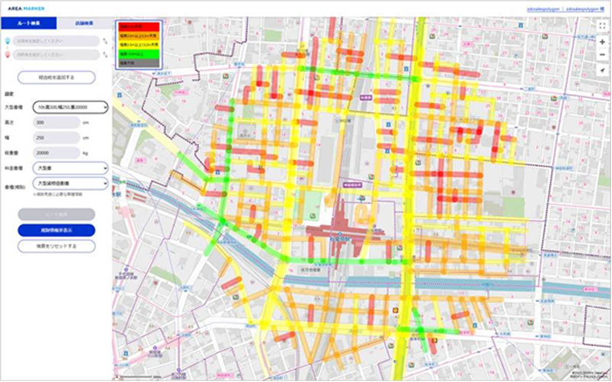
The "Road Width Visualization Function" visualizes the road width around a specified point on the map (within a 500m radius).
<Screenshot of the "Road Width Visualization Function">
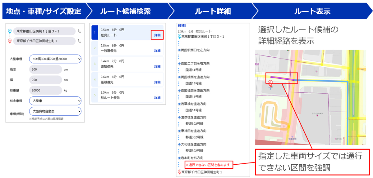
The "Large Vehicle Route Search Function" allows users to set vehicle size and search for routes that large vehicles can travel. When combined with the "Road Width Visualization Function," it becomes possible to understand the large vehicle route to the destination and the road width around the delivery location in advance within the system.
<Screenshot of the "Large Vehicle Route Search Function">
By addressing the need for sudden transshipment and delivery delays caused by the inability of large vehicles to pass, this system supports efficient and safe operational planning in logistics sites and other locations.


